
Digging deep: Fieldwork helping Canada prepare for a hotter, drier future
As peatlands dry and fire seasons lengthen, Greg Verkaik's research aims to better understand how peatlands influence wildfire behaviour - and how we can reduce the risk of deep-burning, smouldering fires.
BY Andrea Lawson
May 26, 2025
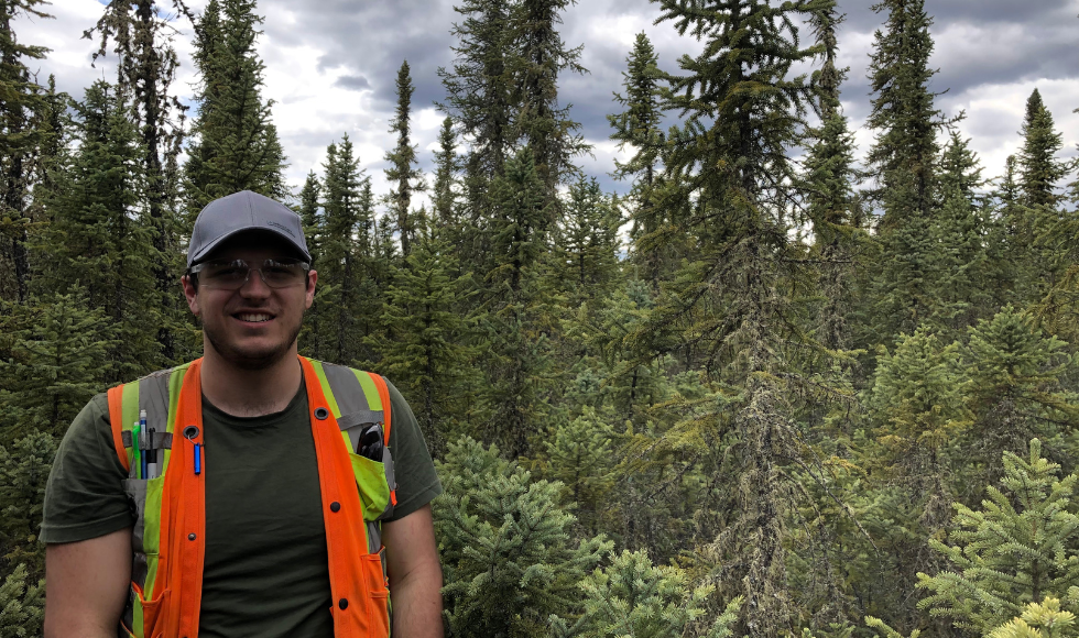
A love of the outdoors and a deep desire to make a meaningful impact on communities affected by climate change keeps Greg Verkaik going back to Western Canada.
The PhD student studies peatlands and their role in wildfires. Climate change isn’t an abstract concept in his research, it’s something he’s been seeing and experiencing in the landscapes he’s visited since 2018 as part of this work.
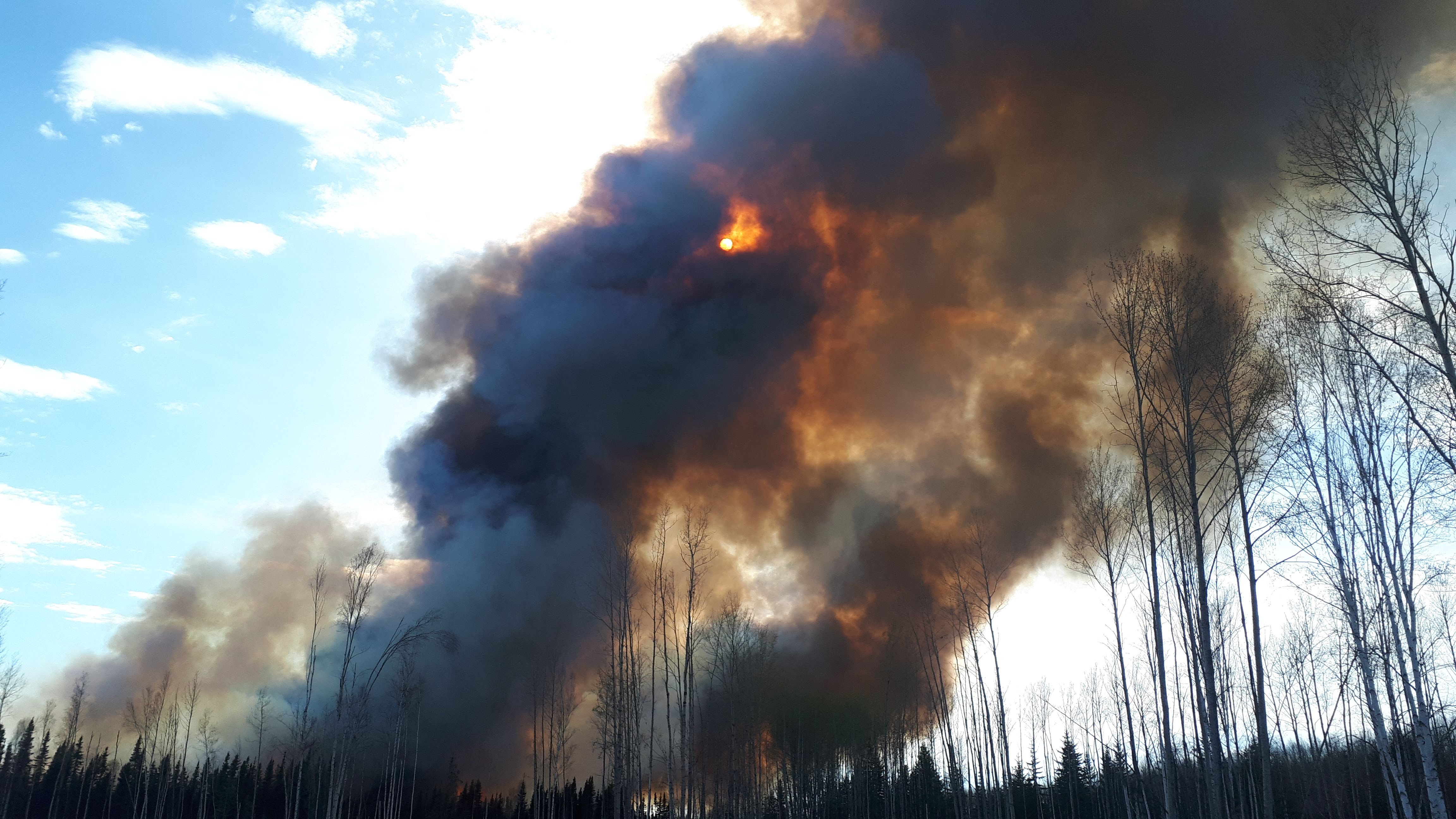
The 2025 wildfire season is already shaping up to be another intense year for Canada. Early signs point to another active and dangerous season, particularly in Western Canada.
As peatlands dry and fire seasons lengthen, the risk of deep-burning, smouldering fires – the kind that can persist underground and reignite months later, continues to grow. This only strengthens Verkaik’s commitment to his research, which aims to better understand how peatlands influence wildfire behaviour and how they might be managed to reduce risk.
“Climate change has led to warmer weather and more frequent and intense wildfires over the past few years,” explains Verkaik, who is a member of the McMaster Ecohydrology Lab. “We’re experiencing more days of the year that have really high fire weather indices, which means that there’s really intense fire if fire happens.”
When it comes to peatlands, Canada is unique. It has the largest area of peatland in the world. It’s an immense and complex ecosystem that presents both opportunities and challenges when it comes to wildfire management.
“Peat only covers about three per cent of the Earth’s land surface. But it holds about a third of the world’s soil carbon, which is about the same amount of carbon that’s stored in the atmosphere,” Verkaik explains.
That makes peatlands critical to the global climate system. But they’re also vulnerable.
“Peatlands store vast amounts of water and carbon,” Verkaik says. “In their pristine condition, peatlands act as fire breaks because they don’t burn as easily. But if you get drainage or high amounts of drought, they’ll carry fire through the landscape.”
And once ignited, peat can burn underground for months, even overwintering and reigniting the following season. In fact, there are overwintering peat fires from last summer that are still burning in northern British Columbia right now.
“It’s really hard to suppress. You have fire crews walking out into the forest trying to dig up this peat and put water on it. It’s incredibly labour-intensive,” he says.
Tracking change on the ground
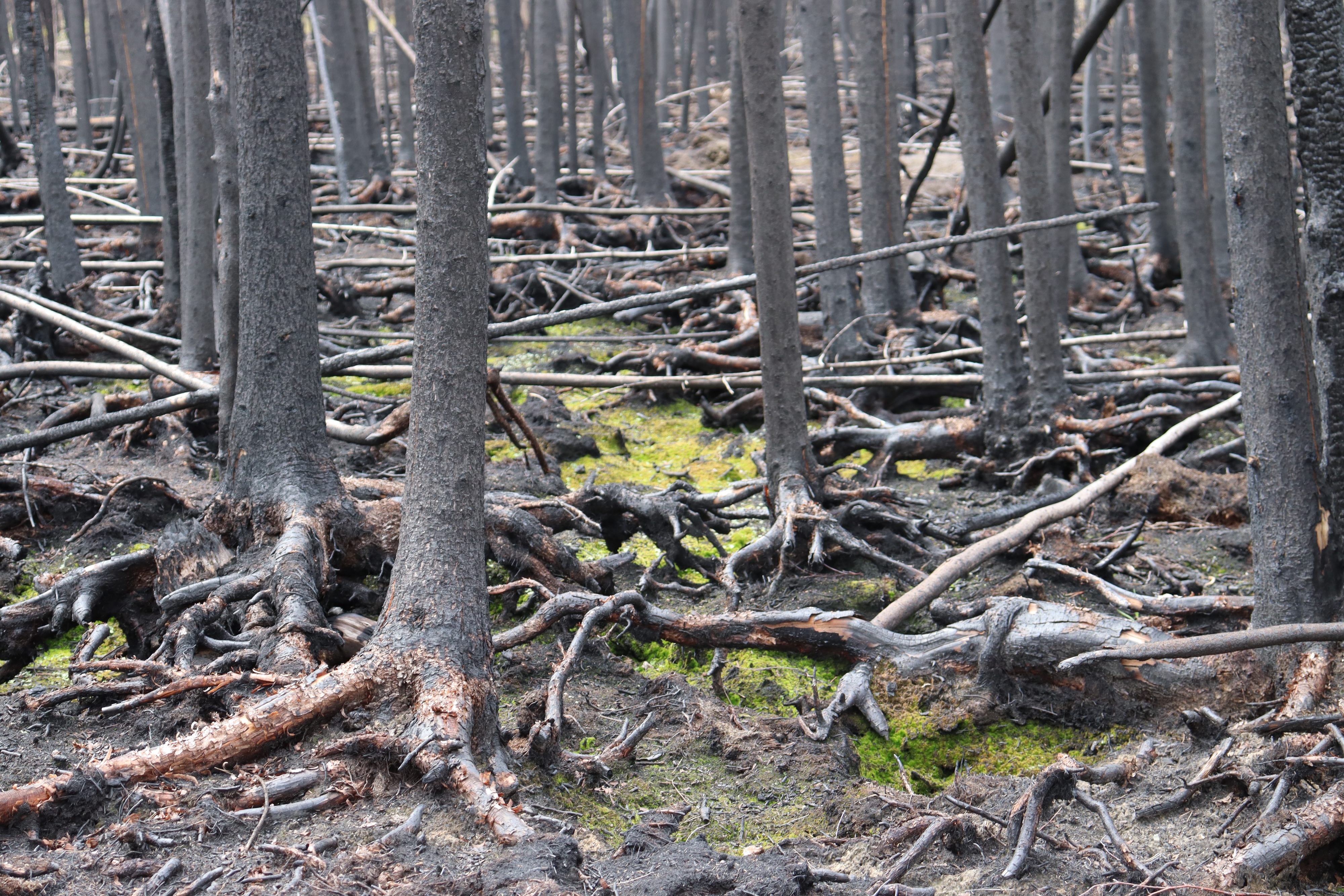
Verkaik travels through several sites across Western Canada to conduct his research. Over the years, he’s noticed a clear shift in conditions — more fires, but also more intense ones that burn hotter, faster and over larger areas.
“There have been years it’s definitely been hotter and smokier,” he says. “We’ve had days where we couldn’t go into the field at all because the smoke was too thick.”
These conditions make fieldwork more difficult and dangerous. Verkaik and his team must constantly adapt, sometimes changing plans on the fly or delaying data collection due to safety concerns.
Despite the challenges, he remains committed.
“Understanding how peat burns and why is key to developing better fire management strategies,” he says.
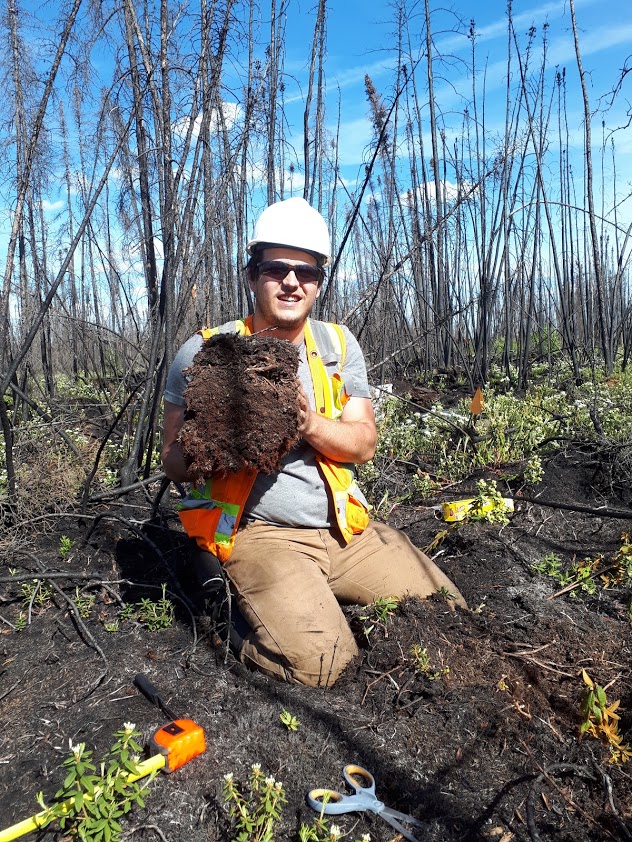
His fieldwork involves everything from measuring the depth of burn in three-by-three metre plots to analyzing tree density and soil moisture. He even uses tree roots as indicators of where the ground surface used to be before a fire.
“We’re trying to build up a story about what’s causing high versus low burn severity in a specific area,” he explains.
To support this work, Verkaik uses cutting-edge tools like remote sensing and LiDAR (Light Detection and Ranging) technology to measure burn severity and identify vulnerable areas within peatland ecosystems. These technologies allow researchers to map fire impacts with precision and monitor changes over time.
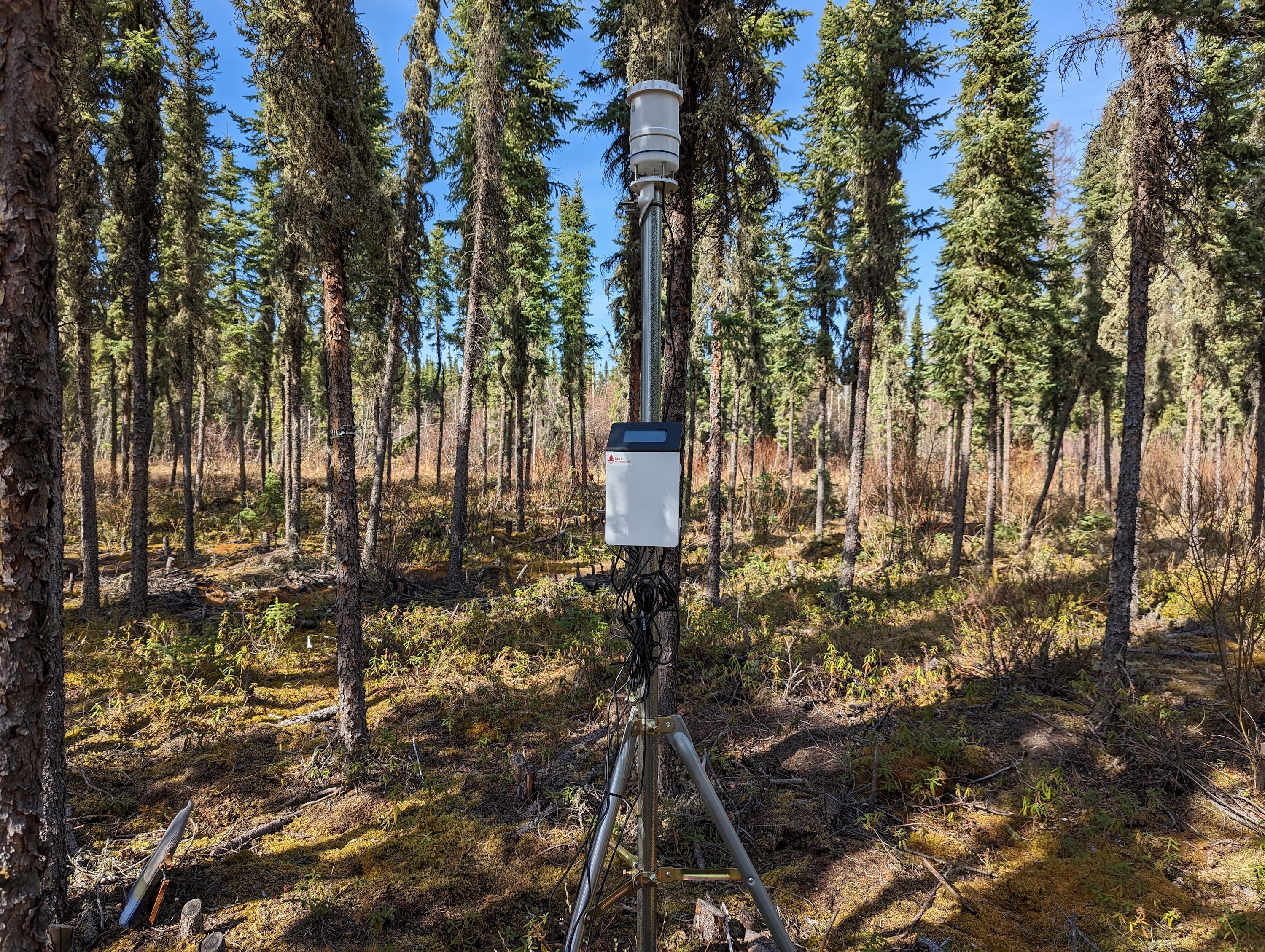
“If you have LiDAR before and after the fire, you can get a measure of the depth of burn,” he says. “That’s important for understanding how much carbon was released and how badly the ecosystem was impacted.”
But high-quality LiDAR data isn’t always available. So, Verkaik is also exploring ways to use post-fire LiDAR to identify areas that burned severely and may still be smouldering.
“If you can fly this LiDAR soon after the fire goes through, you can identify areas that have really big burned-out holes in the ground. Those could be areas fire managers want to focus their suppression efforts on.”
Turning research into action
While fire is a natural part of the boreal forest cycle, Verkaik warns that climate change and human activity are disrupting that balance.
“Historically, fires would come through every 120 years or so. They’d burn off the forest canopy and surface moss, and then the ecosystem would recover and start accumulating carbon again.”
But now, fires are more frequent and more intense.
“If you burn more carbon during a fire and then have less time between fires, the ecosystem doesn’t have time to recover. It might actually become a carbon source instead of a sink.”
Through his research, Verkaik is not only advancing scientific understanding but also helping communities and policymakers prepare for a future where wildfires are more frequent and more severe.
“My focus is really on the practical side,” he says. “Helping fire managers figure out ways of reducing peat smouldering or predicting when peat is going to burn badly.”
He also collaborates closely with fire management agencies, contributing to the development of practical tools like the Peat Moisture Code — a system designed to help predict fire risk in peatland areas based on moisture levels.
“We’re working with Natural Resources Canada on this as part of the next generation of Canada’s fire weather model,” he says.
Is he hopeful? Some days it’s hard to be, he admits.
“But I know there are a lot of smart, dedicated people working on these problems. That gives me hope. Ultimately, I think we’ll figure it out. We have to.”

