
Fragile treasure: Q&A with expert Alemu Gonsamo on the Hudson and James Bay peatlands
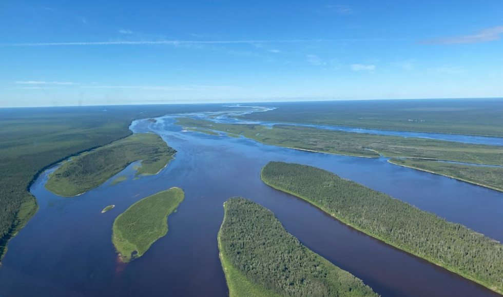
A shot from the fieldwork crew, flying over the margins of Hudson Bay Lowlands and Boreal Shield where the oldest peatlands are interconnected with upland forests, treed-peats, rivers, and water tracks.
BY Andrea Lawson
June 12, 2025
Under the mossy surface of the Hudson and James Bay lowlands is one of the most important carbon storage systems in the world: a sprawling peatland complex that stores more than 30 billion tonnes of carbon.
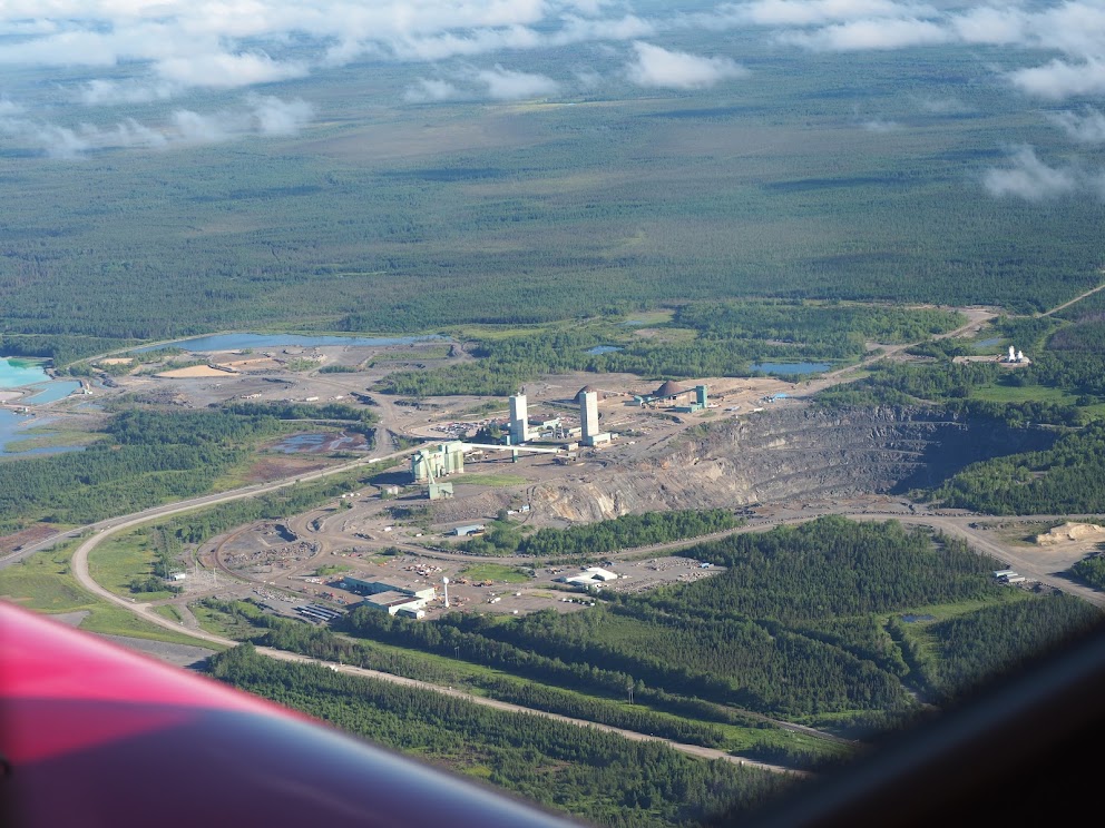
Political momentum is building to develop the mineral-rich Ring of Fire in northern Ontario and build shipping ports in Manitoba, which overlaps with this ecologically sensitive area.
Alemu Gonsamo, a professor in the School of Earth, Environment & Society and senior author of a new study published in Geophysical Research Letters, explains why these peatlands matter and why any development in the area should be done with very careful consultations and long-term preservation in mind.
Can you summarize the key findings of your study and explain why the Hudson and James Bay lowlands are so significant in terms of carbon storage?

The Hudson and James Bay lowlands are important for global climate system and environmental conservation. In our study, we found the region stores an estimated 30 billion tonnes of carbon. That’s a massive carbon storage, and it plays a vital role not only in climate regulation but also in supporting biodiversity.
What makes this area particularly vulnerable is that peatlands are typically waterlogged, which helps preserve the carbon stored in them. But with rising temperatures and more frequent wildfires, the water table can drop, drying out the peat and increasing the risk of carbon release into the atmosphere.
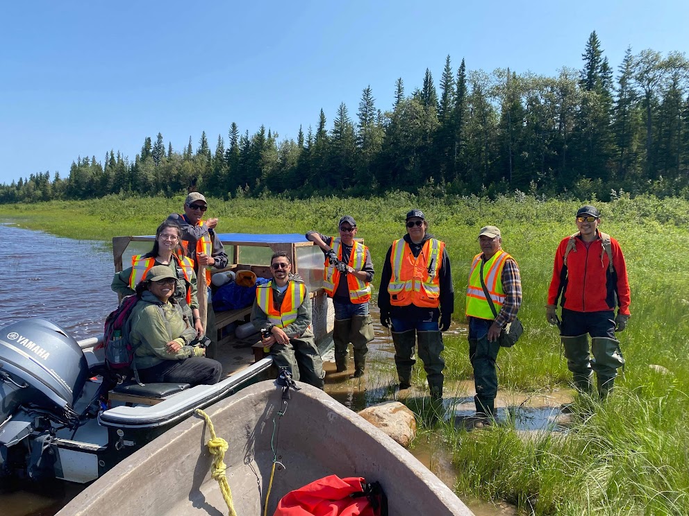
This study took nearly five years to complete. We worked closely with WWF-Canada and Indigenous communities in the region, particularly the Mushkegowuk Council, which represents eight First Nations. We held multiple meetings with the Council, even during the height of the COVID-19 pandemic, to ensure the research addressed their concerns and priorities. Because the region is so vast and remote, with no roads and limited accessibility, it was challenging to conduct fieldwork – it’s easier to get to parts of Alaska than to some areas of the lowlands.
We finally conducted fieldwork in 2022, navigating tides by boat and working closely with Indigenous partners to plan and carry out the research. We were only able to collect about 32-point measurements, which is far too few to map such a large area accurately. To address this, we obtained additional ground measurements from various sources and turned to machine learning. While AI isn’t new in our field, we used a novel approach called ensemble learning, or meta-learning. This method combines multiple machine learning models so they can learn from each other, helping to overcome the limitations of any single model. It allowed us to create a more accurate and continuous map of peat depth across the region.
What’s especially exciting is that this work was led by an undergraduate student in our lab. She recently graduated and is now heading to UCLA for her PhD. It’s a testament to the power of collaborative, community-engaged research and the incredible talent we’re nurturing here at McMaster.
Your study estimates that these peatlands store more than 30 billion tonnes of carbon. How does that compare to other major carbon storages globally, and what makes this ecosystem so effective at storing carbon?
These are among the most significant carbon storages in the world. Outside of Russia, this is the largest peatland complex in the Americas and the second largest globally. What sets it apart is not just its size, but its depth. About 39 per cent of the peatlands in this region have depths between two and three metres, which is substantial when you consider the scale. It is roughly twice the average size of European countries.
This depth is key to its carbon storage capacity – more 30 billion tonnes of carbon, according to our study. That’s an enormous amount, especially when compared to other ecosystems. What makes this region so effective at storing carbon is the way peat accumulates over thousands of years. The area is cold and waterlogged, which slows down decomposition. Plants grow, die, and instead of breaking down, they become part of the peat layer. Over millennia, this process builds up thick layers of carbon-rich peat. Some of these peatlands are around 8,000 years old, beginning to form after the last glacial period as sea ice retreated.
With recent political momentum around developing the Ring of Fire, what are the potential environmental risks of disturbing these peatlands?
The biggest environmental risk comes from the disturbance of the peatlands through fragmentation and drainage. These peatlands are incredibly sensitive ecosystems, and even small disruptions can have major consequences including exposing the ecosystem to raging wildfires that are encroaching towards the lowlands in recent years.

When you build infrastructure through a peatland, things like roads or mining operations, you risk altering the natural water flow. Peatlands rely on consistent water saturation to prevent decomposition. If water is diverted or blocked, parts of the peatland can dry out. That introduces oxygen into the system, which accelerates decomposition and releases stored carbon into the atmosphere. It also increases the risk of wildfires, which can burn deep into the peat and release massive amounts of carbon.
Even without direct drainage, simply fragmenting the landscape can disrupt how water moves through the ecosystem. For example, if water normally flows in one direction and a road or development blocks that path, it can cause one side to dry out while the other floods. That imbalance can degrade the peatland and make it more vulnerable to fire and carbon loss.
Another major concern is habitat fragmentation. These peatlands support a wide range of biodiversity such as polar bears, caribou and millions of birds, including species at risk. Breaking them up can threaten species that rely on large, undisturbed areas.
Development isn’t inherently bad, but it must be done carefully. Environmental assessments need to be thorough and informed by both science and Indigenous knowledge.
What role can Indigenous knowledge play in protecting these ecosystems?
There’s so much that scientists and policymakers don’t know but local communities do because they’ve lived on this land for generations. These insights are essential to designing development plans that minimize harm and preserve the integrity of the peatlands.
Indigenous people understand how the land behaves in extreme cold, how water freezes, and how to safely move from one place to another. That knowledge includes understanding how water flows beneath the snow and ice, and how even small changes can affect the formation of ice roads. For example, if an area dries out because of a development project, it might no longer freeze properly and could cut off access to essential routes.
What would you like policymakers and the public to understand about the long-term consequences of developing this region without fully accounting for its carbon storage capacity?
Any development in the Hudson and James Bay lowlands must be approached with extreme care. This region holds vast amounts of carbon in its peatlands, and once that carbon is released, it cannot be recovered within any meaningful human timeframe.
Unlike forests, which can regenerate over decades or centuries, peatlands take thousands of years to form. If they are disturbed, through drainage, infrastructure development, or fire, the water table drops, oxygen enters the system, and decomposition accelerates. That releases carbon that has been locked away for millennia. And if a fire occurs, it can burn deep into the peat, releasing even more carbon than a typical forest fire. This is not recoverable carbon. You can replant trees, but you cannot re-grow peat within a human lifetime.
What makes peatlands resilient is their waterlogged condition. But with climate change, we’re already seeing warming temperatures and shifting hydrology. In some areas, there’s also permafrost—though it’s discontinuous. As the permafrost thaws, it releases even more carbon that was previously frozen in place, further compounding the problem.
Long-term preservation must be the priority. Development should be guided by scientific research and the knowledge of Indigenous communities. Protecting the hydrological integrity of the peatlands is essential. Without that, we risk triggering irreversible environmental damage.

